Illustrations for SSHRC 2025
This page features illustrations and three-dimensional models to complement Brendan Burke’s 2025 proposal “Fortified Eleon in Boeotia.” Many of these images are not yet published; please do not circulate this page beyond SSHRC evaluators.
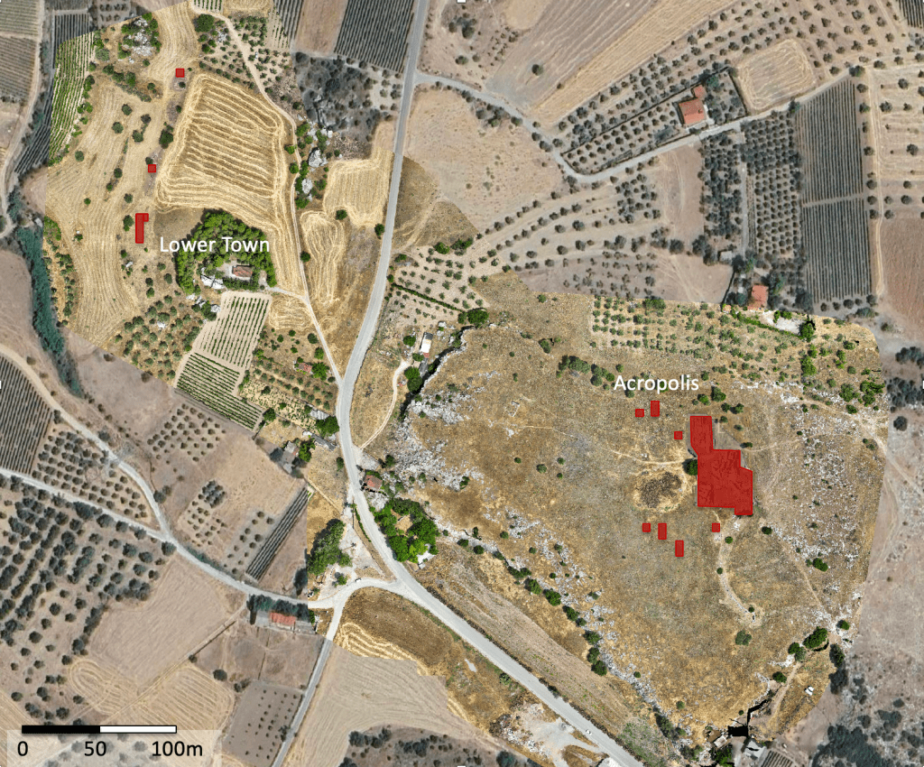
Figure 1. Google Earth satellite image of ancient Eleon with excavated units shaded red.
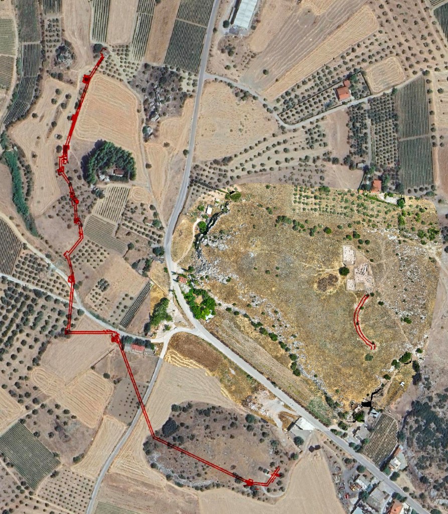
Figure 2. Course of lower town wall of ancient Eleon (ca. 500 BCE) based on excavations and survey 2022-2025.
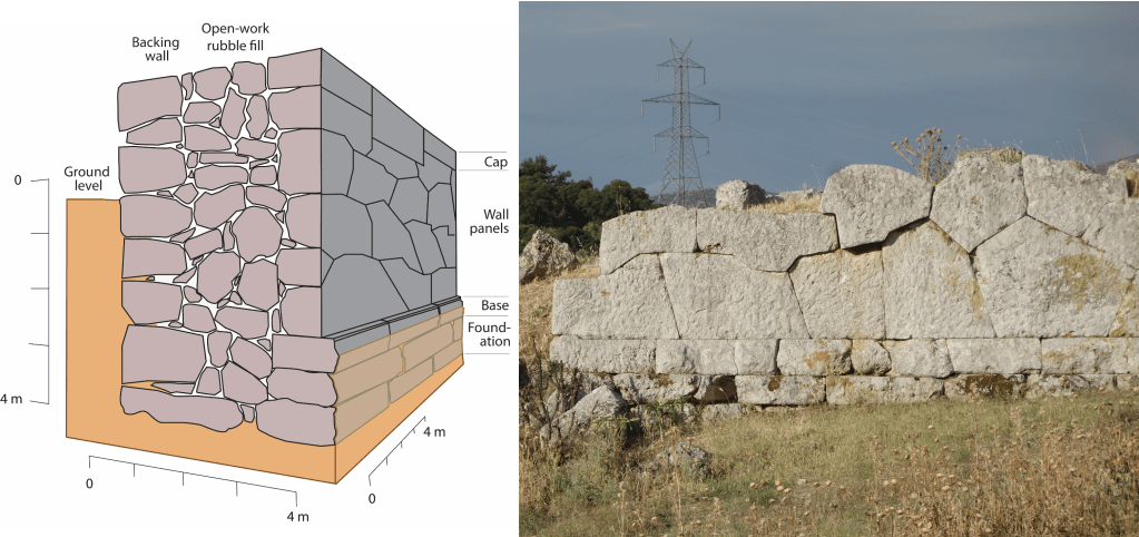
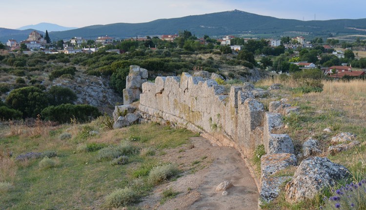
Figure 3. Diagram of acropolis wall construction (Marsh and Jones 2021) and photograph of standing polygonal remains on the acropolis.
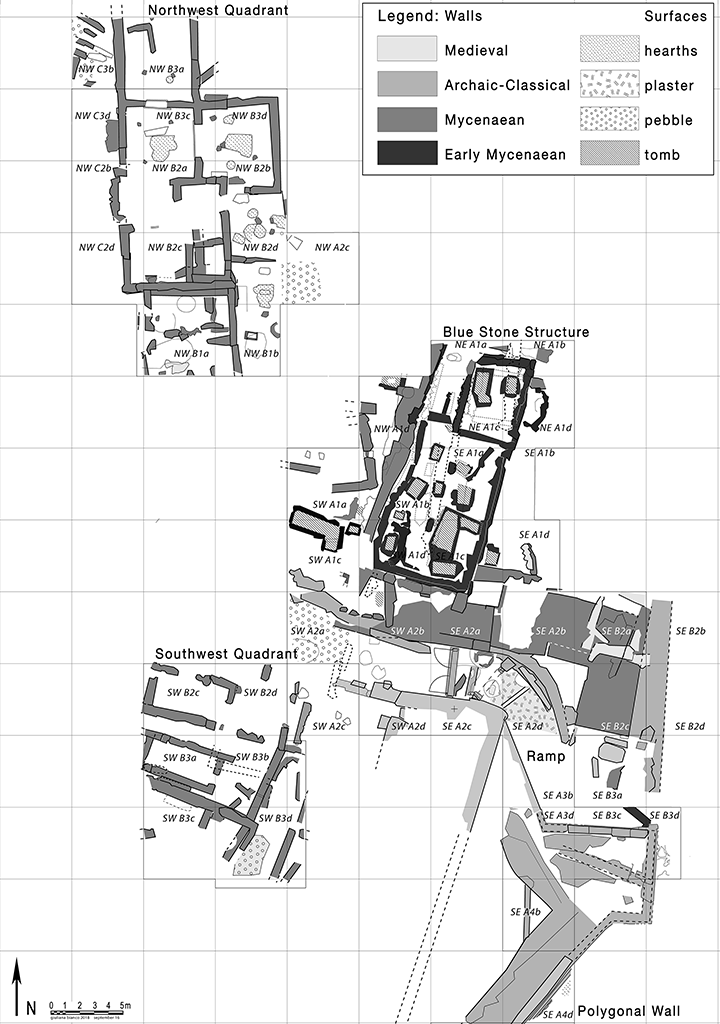
Figure 4. Schematic plan of architecture revealed through acropolis excavations, 2011-2018.
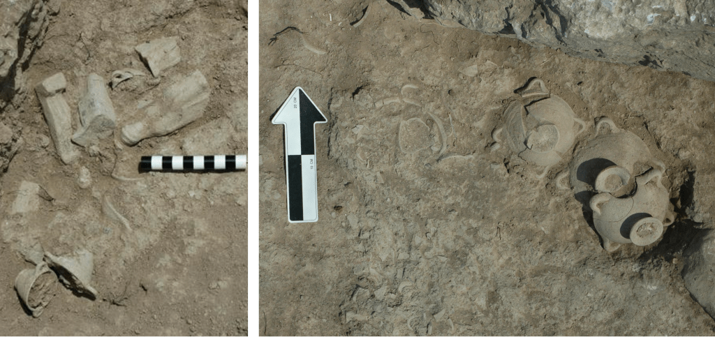
Figure 5. Terracotta figurines, miniature cups, and drinking vessels deposited in acropolis ramp levels.
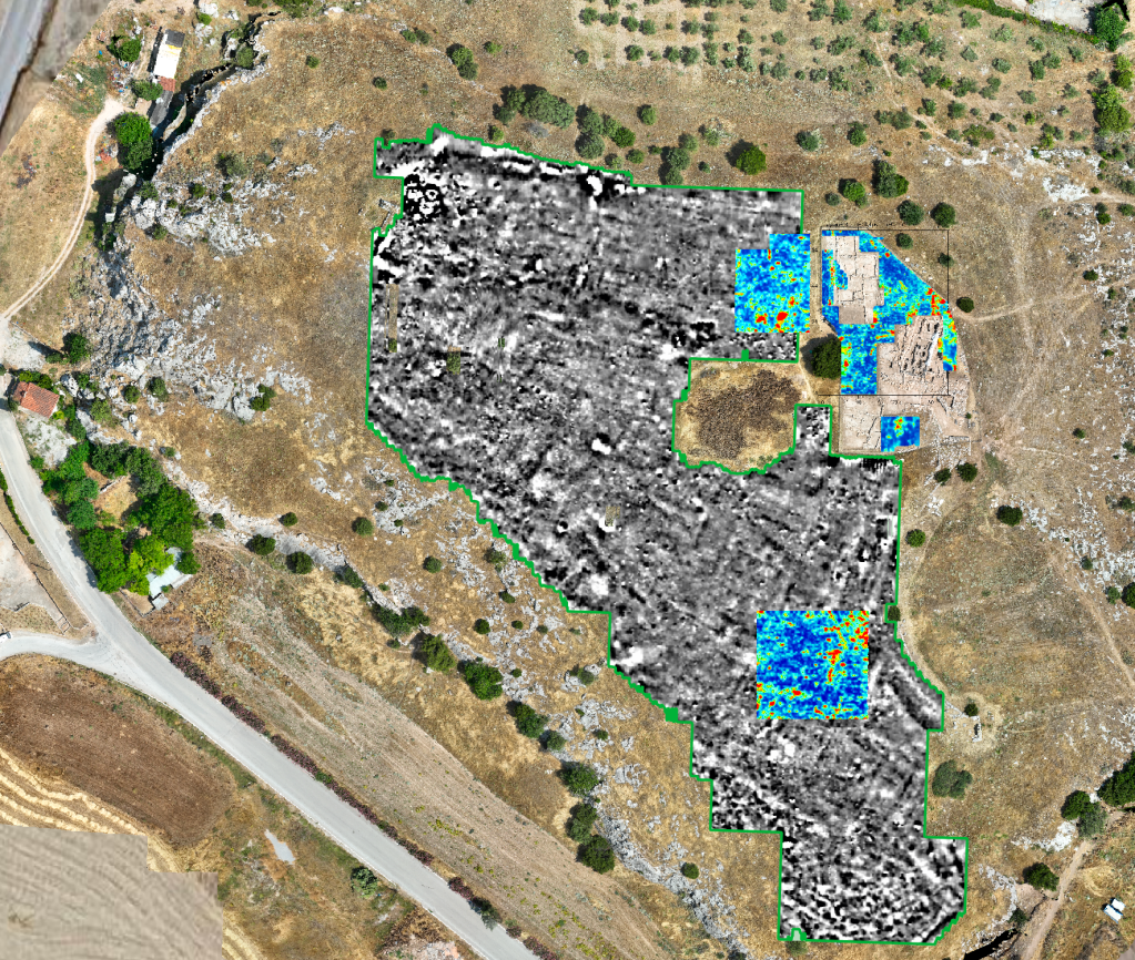
Figure 6. Results of geophysical survey on the Eleon acropolis: magnetometry readings in grayscale and ground penetrating radar in color.
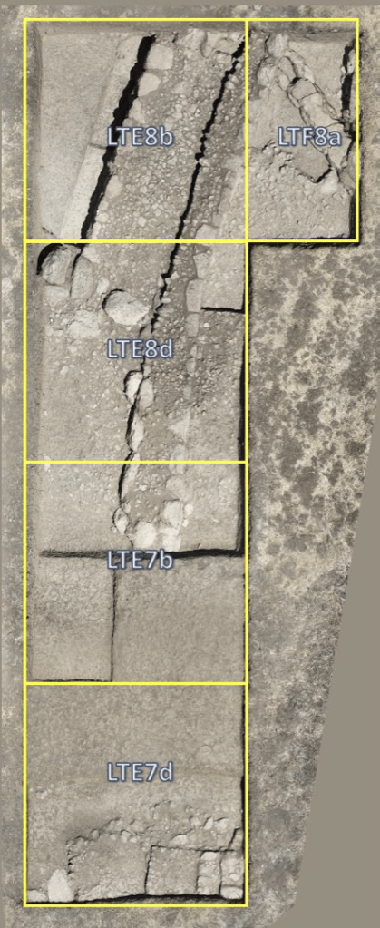
Figure 7. Aerial image of Lower Town excavation units revealing the foundations of the site’s fortification wall.
Additional visuals and 3D models from ancient Eleon can be found on the Digital Eleon page.
