Often the first things I look up when travelling to other places is the local sites and museums: we all love to see some ruins and artifacts. There is a key difference however, between seeing an object in display at a museum and seeing one in context at the site. The same can be said about seeing a site, and seeing a site with artifacts still preserved in it. The latter in both scenarios offers us a unique chance to visualize the context and usage of an object when it was lost to time. Seeing an object in its true context gives us the ability to see what life would be like thousands of years ago; it connects a modern individual to the life of another, that is completely removed from our day to day experience. This is a large part of the reason context is fascinating, but it is also useful, often more-so than the find itself. Below is one of our excavation tags.


What do you record for context? We record the type of finds firstly, the most common being animal bones and pottery. These two finds are not usually given points (a precise location taken through the total station), but the lot and locus are definitely recorded. The locus and lot tell us: A) what feature or area the object was removed from, and B) what pass or day the object was removed during. The date, and trench supervisor are also recorded along with the quadrant and grid square that the finds were taken from. Every find gets an EBAP tag number which is recorded as well for reference. When we find an object that is of a higher rarity, such as an unusual lithic, worked bone, tools, etc, we take points on the object using surveying equipment to record the height that the object was found at, and its location as well. This helps us better understand the utility of a given space on a more precise scale than just recording a lot and locus. Some objects are left in situ (in context) if removal does not seem plausible. This is often the case with pottery and bone where only half of it is exposed and the rest is buried or not loose. In this case the object is left in the ground until the next pass and is then removed and tagged with the latter pass. Vulnerable objects, such as metals, human bones, glass or crystal are removed the day of their discovery, the context recorded with corresponding points if possible, and then preserved in acid free tissue. This processes maintains the preservation of the find, as leaving the object in situ would be more harmful than disturbing a lower layer slightly. Most finds that are of a higher rarity will also get a photo taken with it’s orientation that will also be recorded with the context.
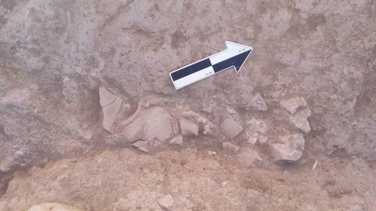
Object in situ with north arrow for orientation.
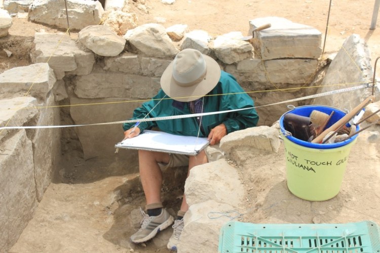
How do you record context? The context of objects is mainly the responsibility of a trench supervisor, who makes sure we have accurate tags and buckets for separate locus and lots, and finds. They also make sure that any soil that is needed for dry sifting has a tag, in addition to any bones or sherds, and any artifacts. They are also the ones who record the points we take with the total station in both their field notes and a total station booklet. Another important tool for recording context is the total station. This tells us elevation and location. We use this for opening and closing points on new layers, as well as marking off distinguishable features and finds. We also utilize our architect’s drawing abilities to get gain a reliable image of the stratigraphic layers and the general outline of any architecture, as well as photographs. This is complete with elevations, that are recorded through the dumpy level which gives us the context of walls that we have removed, or any potentially important slab or stone. Any stratigraphic layers are lotted with their finds recorded separately from the previous for dating. We divide the site into quadrants, NW NE SW SE, as well as dividing the quadrants into trenches, these then get divided further into loci and lots, all of which help us to tag and keep track of all of the material covered.
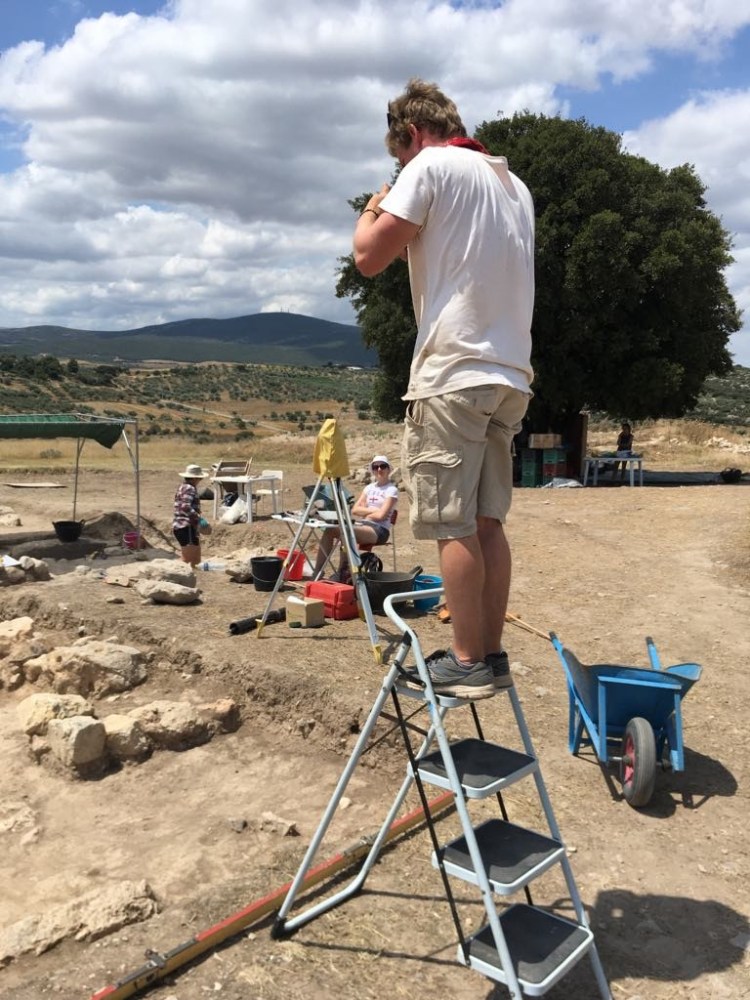
Using the camera to record the top layer of a new trench, and drawing/measuring the architecture.